Free Printable PDF
Asia Map Coloring Page for Kids
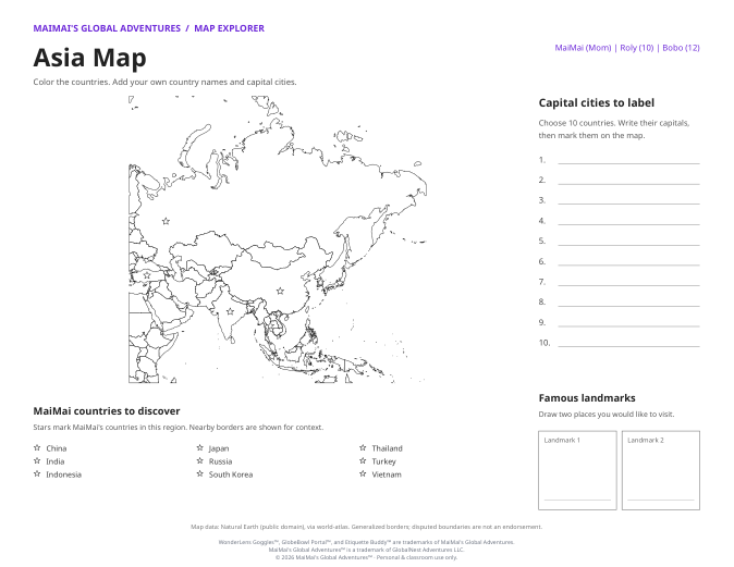
Free printable asia map for kids. Includes country outlines, country-labeled and unlabeled PDF variants, capital-city writing lines, and landmark drawing boxes for home or school.
No sign-up required. Print at home or school.
Choose your version
About the asia map
- A real outline map of Asia, with country boundaries, MaiMai adventure stars, capital-city answer lines, and landmark drawing boxes.
- Both stored versions show country boundaries. The labeled version includes country names where space allows; capitals are an activity to research and write, not a printed capital-city answer map.
- Generalized borders are for learning. Disputed boundaries are not an endorsement. Map data: Natural Earth, via world-atlas.
- Suggested use: primary-age learners with an adult, or independent geography practice for confident readers.
How to use this printable
- Print the PDF in landscape orientation.
- Color neighboring countries in different colors.
- Use the country-labeled version for reference, then try the unlabeled map.
- Choose ten countries and research their capitals for the answer lines.
- Draw two landmarks you would like to visit.
Want more cultural printables?
Join MaiMai for free flag coloring pages, country worksheets, recipe cards, and more, built for kids ages 3 to 18.